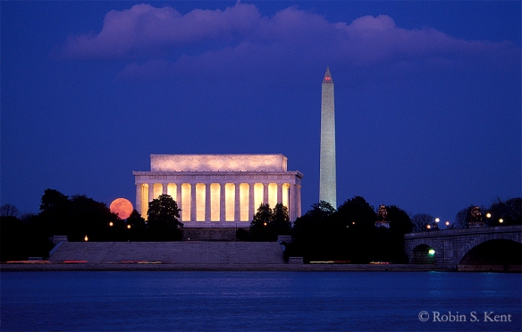
 Moonrise, Lincoln Memorial
Photographing the moon, stars, and the Milky Way brings a different set of challenges, most often in planning where to be and when. Happily, this is no longer as hard as it used to be, because there are various apps such as The Photographer’s Ephemeris (TPE) or PhotoPils that enable you to predict where the moon and other astronomical bodies will be at any given time and location.
The picture above was taken in 2001 when such things did not exist. You needed a compass and a chart with the azimuth of the moonrise. On March 9th, the moonrise was at 6:19 PM, 10 minutes after sunset.
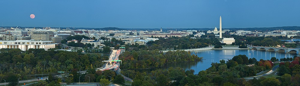
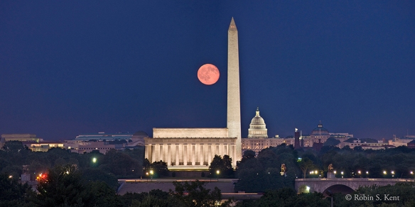 Moonrise over Washington DC
(Tech: Nikon D200 with 18-200mm f/3.5-5.6 lens, @ 200mm, exp: 1.8 sec. @ f/5.6, ISO 200; 3 vertical images, photomerged)
Capturing a full moon rising over Washington, DC from this location near the Netherlands Carillon is a much desired goal of many local photographers. These days, when the alignment is expected to be good, you will find as many as 100 photographers at this location poised for the opportunity.
The image above, however, was photographed on Sept 5, 2009, the night after the full moon, and also back before TPE and other apps were generally available. There were less than a half dozen photographers up there that night. The next chance for an almost identical shot at this location will be on October 5, 2019.
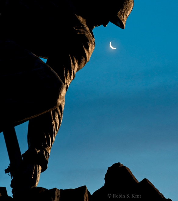 Iwo Jima and Crescent Moon
The moon doesn’t necessarily have to be full to find an interesting angle, but it might mean that you have to get up early in the morning. This was taken at about 5:20 AM, during civil twilight when the waning moon was about 19% full.
(Tech: Nikon D200, 18-200 f/3.5-5.6 lens at 200mm; exp 0.6 sec. @ f/20, ISO 2500)
 Lunar Eclipse Multiple Exposure
(Tech: October 8, 2014, Total of 18 Exposures over a 64 minute period, exposures varied depending on brightness of moon)
A lunar eclipse is a relatively rare event, but it can be photographed in a variety of ways depending on the timing and track of the moon across the sky. In this case of an early morning eclipse, I tried an application of the stacking technique I learned in a Michael Frye workshop for shooting star trails (discussed below). The next total eclipse in Washington, DC will be on the night of 20-21 January 2019. Information of the date and locations of upcoming eclipses anywhere can be found here.
 Milky Way over Gaylor Lake, Yosemite National Park
When photographing Stars, one has to get away from the light pollution of city lights. Dark skies, such as Yosemite National Park, are increasingly rare. One place to find them is at the Dark Sky Association website.
This kind of photography involves a number of considerations. According to Michael Frye: “Capturing pinpoint stars requires relatively short exposures, otherwise the stars become streaks instead of points. You can get away with exposure times as long as 30 seconds with wide-angle lenses. To gather enough light to show faint stars and the Milky Way with such short exposures, you need both a wide aperture and a high ISO. The wider the aperture and the higher the ISO, the more stars will appear in your photograph. But you might not want to use the widest aperture on your lens, because all lenses are sharper when stopped down a bit. Or if you have something in the foreground you may need to stop down slightly to get sufficient depth of field. To start with, try 15 to 30 seconds at f/2.8, with the ISO at 6400. If that doesn’t show enough stars, try a wider aperture or higher ISO.”
The Milky Way is not visible in the Northern Hemisphere during January and February. For a comprehensive discussion of when and where to photograph it, check this link.
 Star Trails, Sonora Pass, California
The technique for capturing star trails is similar to shooting the Milky Way in that a fast (f/2.8 or better) wide angle lens (24 mm or wider)are necessary. But instead of one relatively short exposure, this kind of image requires a series of long exposures at a relatively low ISO. The above image involved 30 separate exposures, each four minutes long with a 1 second interval between each one. The aperure was f/5.6 and the ISO was 400. An intervalometer was attached to the camera to manage the sequence of shots.
Then, during postprocessing, you can load all the images into photoshop as layers. You then click off the visibility (the little eyeball on the left of each layer) of all layers except the bottom layer. Then Cchange the blend mode on all layers to “lighten” and the star trails will appear. This action blends the layers together keeping only the lightest areas of the photo. Merge the image as a single layer.
I hope these three posts on low light photography are of some use to readers interested in taking on the low light challenge. For now, however, I will be taking a break from my blog for about 6 weeks as I get ready for an upcoming trip to the monarch butterfly preserves in the Sierra Madre Montains of central Mexico. You can get an advanced peek at what I hope to see there by checking out my post from 2016.
You cn also check out my Instagram feed (@photographybykent) which will have occasional posts over the next several weeks. In the meantime,
Keep Shooting……….
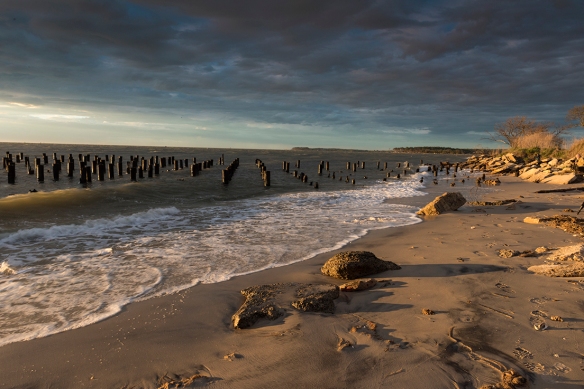
 Moon over Abandoned Pilings, Marquette, Wisconsin
 Night at the Museum, NASA Shuttle Enterprise in the Udvar-Hazy Center
 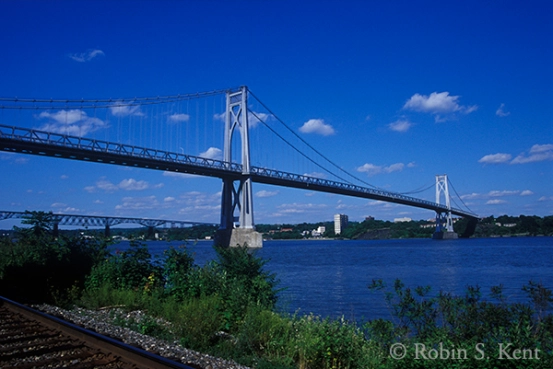 Mid-Hudson Bridge, Afternoon Scouting Image
 Mid-Hudson Bridge at Dawn, (the next morning)
 Transition from Day to Night
 WW I Memorial at Twilight, Washington, DC
 Kennedy Center at Twilight, Washington, DC
 WWW II and Washington Monument at Night
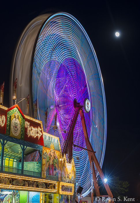 County Fair with Moon, Madison, Wisconsin
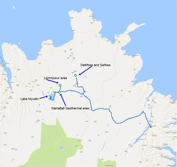
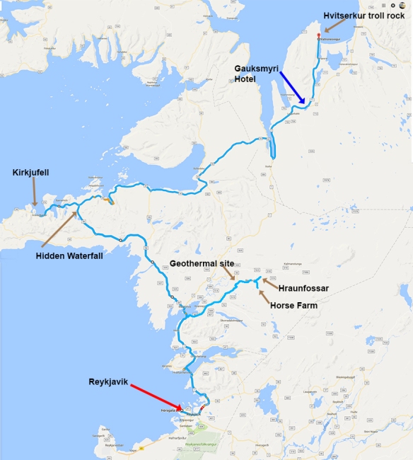
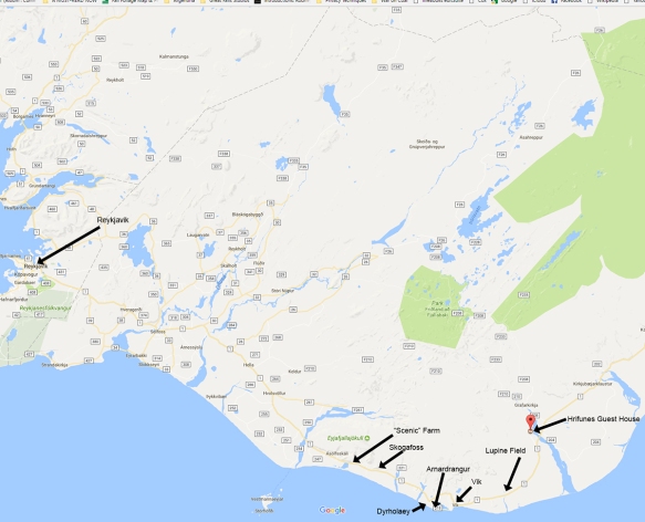 Map of Southern Region
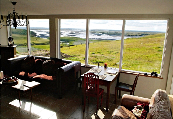 View from the Reading Room, Hrifunes Guest House
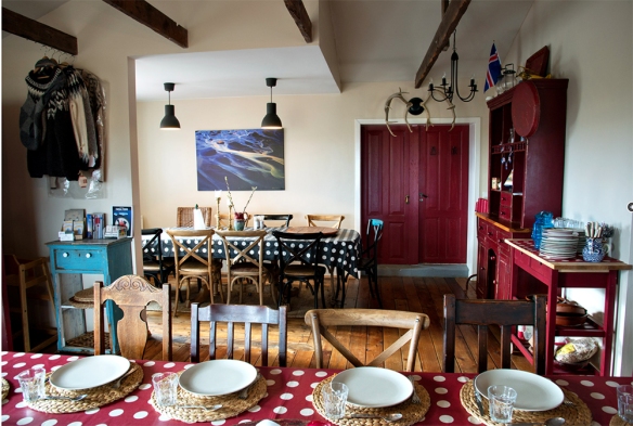 Dining Area of Hrifunes Guest House
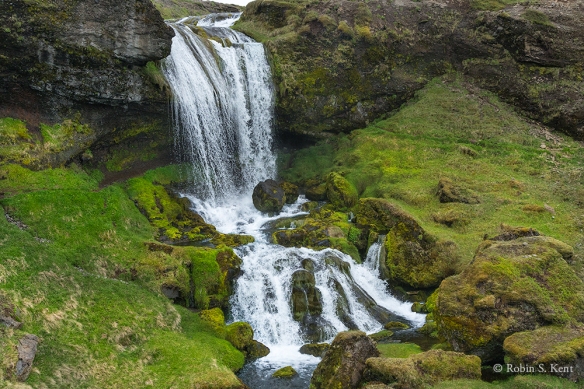
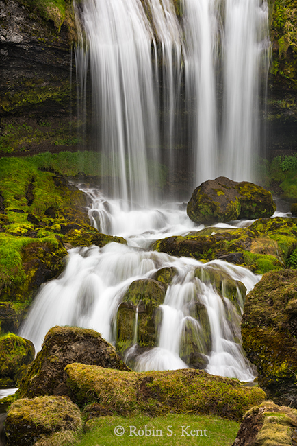
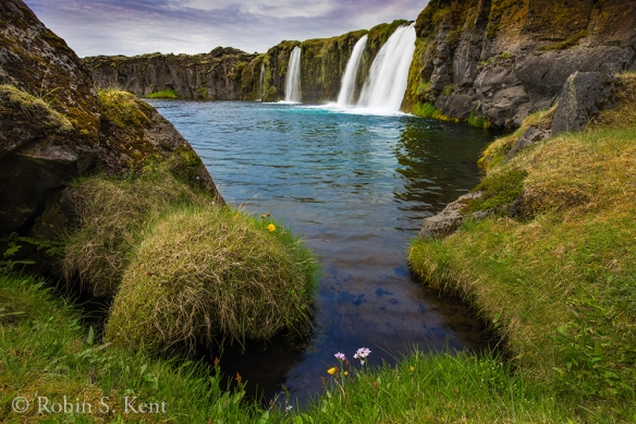 Undisclosed Location, Southern Iceland
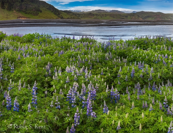 Field of Lupine
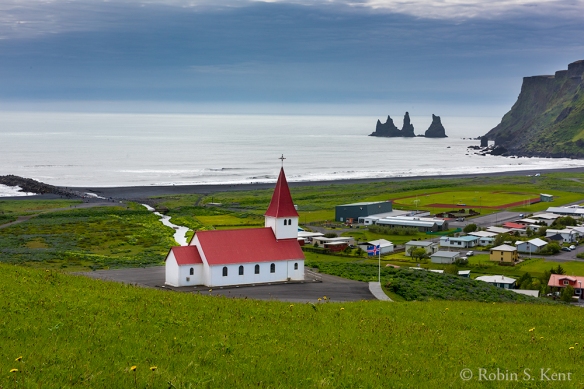 Hillside Church Overlooking Vik and Reynisdrangar Sea Stacks
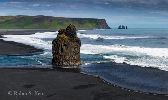 Arnardrangur, with Reynisdrangar Sea Stcks in the Distance
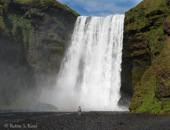 Skogafoss, Mid-Afternoon Light
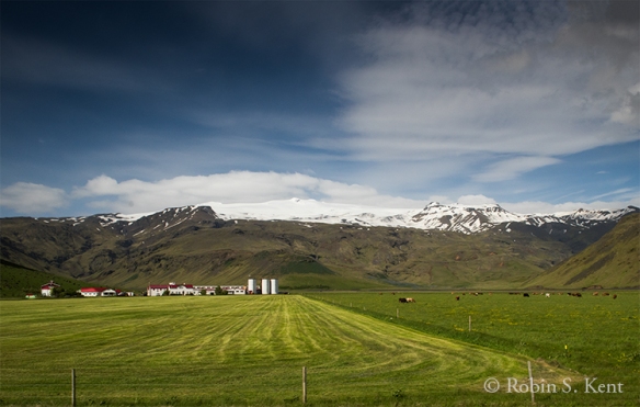 Family Farm in Idyllic Setting
 Detail Map of Area near Jokulsarlon


 Rick and Michele setting up their shots at Fjallsarlon

 Volcanic Crater, Early Morning after a Snowfall
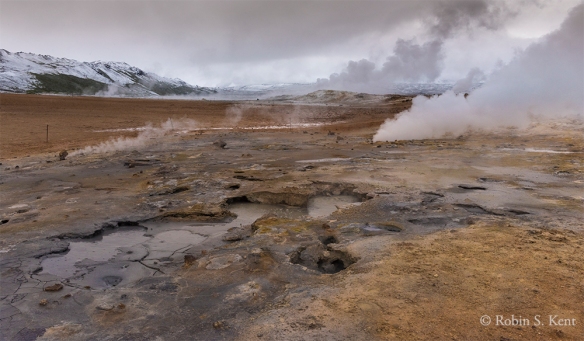
 Namafjall Geothermal Field
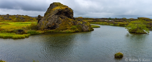 Unnamed Lagoon, Somewhere on Highway 1, Lake Myvatn Region
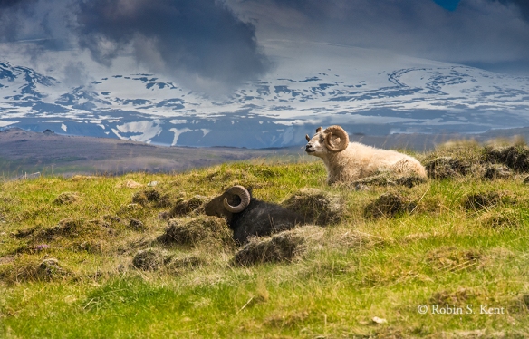
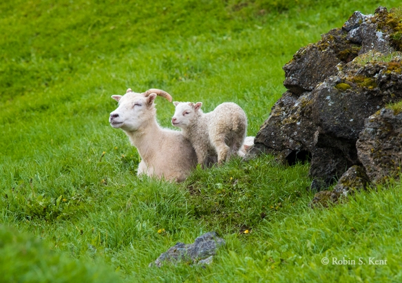 Lamb with its Mother, Somewhere on Highway 1, Lake Myvatn Region
 Snow on Mountains, Somewhere on Highway 1, Lake Myvatn Region
 Leirhnjukur, View from the Trail (note hikers on top of the hill)
 View from the Overlook, Leirhnjukur (Trail is along near edge of black lava field)
 View from Leirhnjukur (Taken just before we began the descent back down to the car)
 Dettifoss, View from East Side
 Dettifoss, View from East Side (Taken from the edge of cliff about 50 feet above the river)
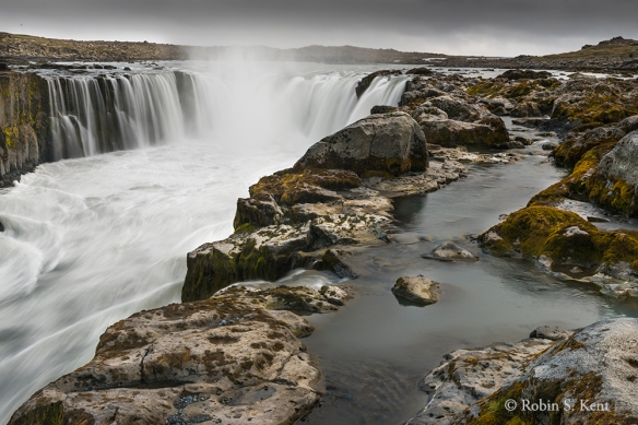 Selfoss, View from East Side


 Sea Lion Yawning
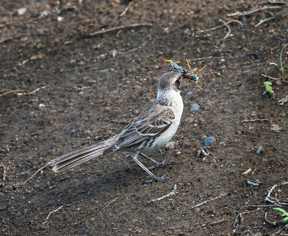 Galapagos Mocking Bird
 Sunrise, Floreana Island
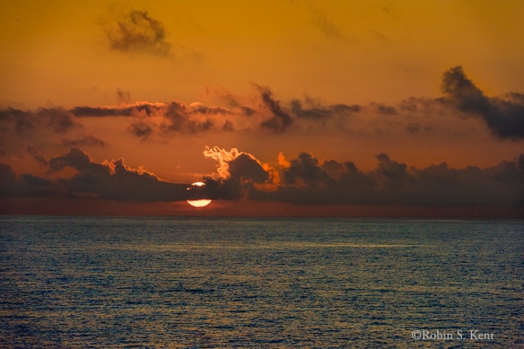 Sunrise on the Equator, Pacific Ocean
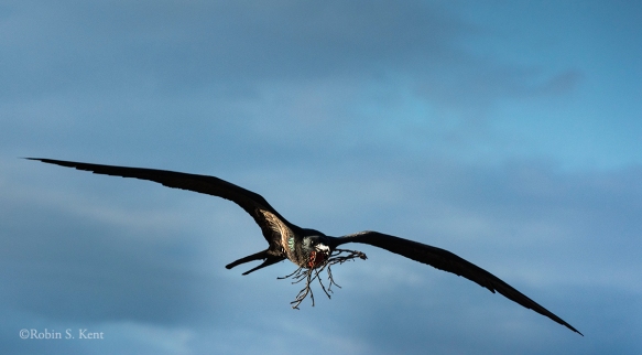 Frigatebird Carrying Nesting Material
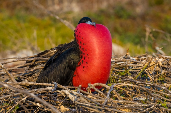
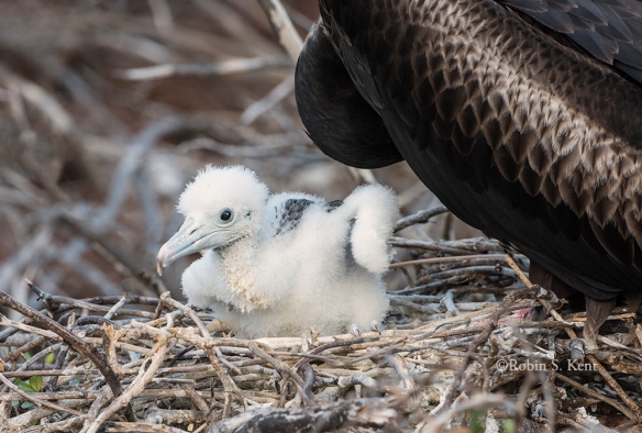 Young Frigatebird Chick on Nest
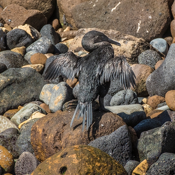
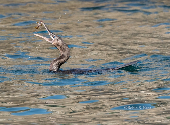 Flightless Cormorant with a Catch
 Sally Lightfoot Crab (Yes, really!)
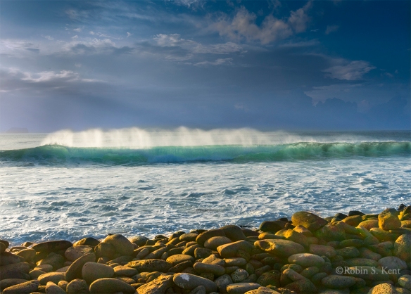 Wave Breaking in Late Afternoon Light