Iceland (Part 5): Eastern Region


Detail Map of Area near Jokulsarlon

After four consecutive days in a different hotel every night, we slowed the pace a bit and signed up for two days at the Hali Country Hotel, just up the road from the famous Jokulsarlon glacial lagoon and the black sand “Ice Beach.”  Our guide, Haukur, had also arranged for an early morning visit to a puffin colony at Cape Ingolfshofdi.

View from the “Trail” leading down from Cape Ingolfshofdi  as we return to the SUV

Puffins spend most of their lives living in the open ocean but in the spring many of them flock to coastal colonies in Iceland.    But it takes some effort to get close to them as the image above suggests.  There was no road and no visible trail to the base of the promontory where the puffin colony was located.  The several kilometers of splashing through marshes and undulating fields of soft lava ash makes one imagine they are testing a prototype for a new carnival thrill ride.  Then comes the hard part, trudging with a pack of camera gear up a steep slope of lava ash and sand, something akin to climbing a sand dune.

But at the top, one finds a field of lush green grass which stretches out invitingly….to a sudden drop off a vertical cliff high above the ocean.  The puffins nest in burrows they have found or excavated themselves, bringing in grass and feathers as lining for the chicks.

The puffin’s diet consists almost entirely of fish, which it captures by swimming under water using its semi-extended wings as paddles and its feet as a rudder. We couldn’t stay too long in any one spot because the puffins would wait until we were a safe distance before entering their nests and feeding their young.

As cute as the puffins are, their neighborhood has a bad element…a large thug of a bird known as the great skua.  The skuas build their nests on the ground out in the open, almost as bait for naïve trespassers whom they attack with with fiendish glee .

When a bird this large (4-foot wing span) is heading directly at your face…….

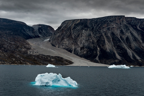
The Jokulsarlon glacial lagoon is not far from Cape Ingolfshofdi and is a favorite stop for most visitors because of its dramatic scenery, easy access, and its full range of services (café, souvenirs, boat rides, etc.)  Icebergs breaking off the Vatnajökull glacier float in the lagoon eventually working their way out a narrow channel into the ocean.  Once in the ocean, many will be pushed up by the tide onto a black sand beach, the famous Ice Beach, providing numerous opportunities for photographers.

Jokulsarlon Glacial Lagoon

At the back of the parking lot away from the tourists, a flock of Arctic Terns had taken possession of a field  for a nesting colony.  The tern is famous for its incredibly long migration route, the longest-distance migration of any bird, moving between its Arctic breeding grounds in Iceland and Greenland and its non-breeding territory in the Antarctic, a distance that approaches 25,000 miles. And they share one characteristic with the skua: the ferocity of their attacks on trespassers.  Although they are much smaller, they use a team approach, overwhelming the target with their numbers.

(Nikon D810 & 24-70mm f/2.8 lens @ 70mm; 1/5,000th sec @ f/7.1, ISO 400)

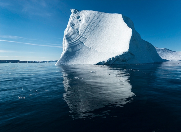
There is a second glacial lagoon, Fjallsarlon,  just a few miles down the road from the far more popular Jokulsarlon.

Rick and Michele setting up their shots at Fjallsarlon

The lagoon is smaller than Jokulsarlon; there are no tourist services and the water is not as blue.  But the solitude was a nice contrast.  When it was time to leave, Haukur suggested a short hike to some nearby ponds where we might find some geese.

Barnacle geese with goslings

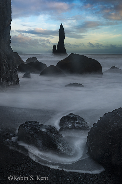
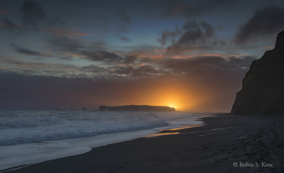
One of the most magical experiences on any Iceland tour is a visit to the Ice Beach.  It is here that the last remnants of a dying glacier wash up on a black sand beach and complete their thousand-year life cycle.  These stranded crystal sculptures seemed almost alive as the surf swirls around them, refracting and reflecting the dim light of the late evening.

Last Vestiges of a Glacier


Next:  Lupines and More…….

Northwest Passage (7)

Prince Regent Inlet, one of the several choices now available for transiting the Northwest Passage, is packed with historical locations some of which date back almost two millenia.   It is also brimming with potential for wildlife sightings.  However, we were also experiencing some heavy weather with strong winds and choppy seas, so the plans for a landing at Fury Beach to observe the 191st anniversary of the scuttling of the HMS Fury had to be—well, scuttled.  (Those interested in further details about the Fury and Edward Parry’s search for the Northwest Passage can find more here.)


prince-regent-01-d-16-08-25-8866-blog

Polar Bear, Unimpressed by our Little Armada

But Plan B turned out pretty well.  A sheltered bay was located that included a polar bear walking along the beach.  Zodiacs were launched and the bear cooperated by staying put, relatively close to the shore.  It was working on a carcass of an unidentified animal and as long as we didn’t get too close, it seemed uninterested in us.

prince-regent-d-16-08-25-9004-crop-usm-blog

(Tight Crop, Nikon D810 with 70-200mm f/2.8 and 1.7x tele-extender, handheld, 1/200th sec. @ f/4.8, ISO 800)

That evening, our ship hosted the crew of the s/v Vagabond, a 47-foot sailboat especially fitted for overwintering in the Arctic.

prince-regent-03-d-16-08-25-9025-blog

S/V Vagabond

We had passed them a few days earlier and our captain arranged for them to come aboard for a presentation on their research work and what life is like living on a small boat in the Arctic winters.  It was an unusual crew, Eric Brossier, his wife France, and their two charming daughters aged 6 and 8 years old.  Their main activity is data gathering for a variety of research institutions on a wide range of topics.  They also derive income from providing logistical support for filmmakers, photographers, and others.  More on the Brossier family can be found here.

Later that day, another Zodiac run took us to Fort Ross, the site of an abandoned outpost of the Hudson’s Bay Company.

prince-regent-07d-16-08-26-9305-blog

This outpost was built in 1937, abandoned 11 years later

The organization has a long history in North America, dating back to 1670.  The original land grant was equivalent to 40% of the total land area of modern Canada.  Known first as the dominant fur trader in North America, it is now a major international retailer, owning such subsidiaries as Saks Fifth Avenue.  More about the company’s history can be found here.

prince-regent-04-9315_18-hdr-blog

HDR image of interior of living area

Approaching the southern tip of Somerset Island the next day, another Zodiac excursion took us into Hazard Inlet.

prince-regent-06-9231_35-pano-blog

Overlooking Hazard Inlet

 Here we had our first chance to walk on tundra, something akin to stumbling across an enormous sponge with hidden crevices and random sogginess.  Over a thousand years ago, small populations of both the Dorset and subsequently the Thule cultures lived here long ago.  The Dorset people arrived in the Arctic as early as 500 BC and were displaced by the Thule (arriving between 900-1100 AD).  The Thule are the ancestors of the modern Inuit inhabitants of the Arctic.  Scattered archaeological remains of the settlements could still be seen, including gravesites with skeletal remains forced to the surface by cycles of freezing and thawing over the eons.  We were starting to notice a theme of the difficulties humans have had surviving in this harsh environment.

The tundra seems hospitable to the small flowering plants scattered about.  They were already fading in anticipation of the approaching winter, but aging boulders were festooned with colorful displays of lichen.

prince-regent-d-16-08-26-9280-blog

Lichen on Boulder


Next up:  Bellot Strait, named after a charismatic French explorer who searched in vain for the lost Franklin Expedition


Northwest Passage (6)

Beechey Island 

Warning: Historical Narrative Ahead!

It was early morning and the ship was moving cautiously through the gloom of Lancaster Sound.  A light rain driven by a brisk wind pelted the foredeck but our eyes were riveted on the hulking island that lay ahead of us.  We were now in the waters of the Canadian Arctic Archipelago following the track of 19th century explorer Sir John Franklin who had searched for the elusive Northwest Passage 160 years ago.  Our goal today was to land on Beechey Island, and we all knew this was where his ill-fated expedition had begun to unravel.

d-16-08-24-8536-beechey-06-blog

Scouting Team Heads to the Shore of Beechey Island (8:45 AM)

Even today, transiting the Northwest Passage is not a routine undertaking.   What Franklin and his 129 crew members were attempting in 1846 would not be accomplished for another 60 years. The environment here is far less hazardous now than it was then. In fact, it is much different than it was 10-25 years ago.

What sets Franklin’s attempt apart from the many other failures was the enormity of his disaster.  The full story still is not known but the two ships and all 129 aboard essentially vanished.  As numerous search expeditions gathered clues over the next decade, it became apparent that the two ships had been trapped in the ice, were abandoned, and the survivors had begun an agonizing and horror-filled death march through a frozen and merciless landscape in a vain attempt to find help.  It was not until 2014 that one of the ships was found; the other was still missing although we knew an active search was underway several hundred miles to the south (see red arrow on map below).

d-16-08-24-8551_53-beechey-07-blog

Ruins of Northumberland House, built in 1853-54

The image above shows the remains of a supply depot constructed to support the massive rescue effort for Franklin and his crew.  The depot quickly proved its value in 1854 for the crews of the supply ship that sank offshore and four other ships that had been trapped in the ice and were abandoned.  (One of the latter four, the Resolute, eventually broke free on its own, was found 18 months later by an American ship, was refitted, and given back to the British.  Two decades later, wood from the decommissioned Resolute was used to make 3 desks, one of which was a gift from Queen Victoria to the US President.  It is still in the Oval Office.)

d-16-08-24-8619_21beechey-08-blog

Gravesites of Three Members of Franklin’s Crew

It was on Beechey Island that the first clues to Franklin’s fate were found by a search party six years after he disappeared.  Remains of several small structures and other relics showed they spent their first winter here.  More ominously, the gravesites of three of his crew members indicated that problems had already occurred (see image above).  But 126 men and the two ships were unaccounted for and their prospects were grim.  It was now 3 years after their supplies would have been exhausted.   And the barren landscape surrounding the gravesites hinted at the horrors that faced the crew at that point.

map-of-franklins-route

Map of Franklin’s Route

(From James P. Delgado, Across the Top of the World, 1999, p.113)

Some 40 expeditions were launched in the search over the ensuing decades and little by little, more clues were uncovered.  Today, much more is known but key elements remain a mystery.  The Zodiac ride back to the comfort of our ship was subdued as we tried to imagine how different the conditions were in those days.  We had yet to even encounter a piece of sea ice.

d-16-08-24-8712-beechey-09-blog

Sea Ice, North of Somerset Island in Barrow Strait (4:30 PM)

As if reading our minds, the captain decided to alter the route to give us a glimpse of sea ice conditions (see image above). It stretched for a number of miles but was neither as thick nor as expansive as one would have encountered only ten years ago.  We would experience sea ice only one more time and that also would require a substantial route deviation.

d-16-08-24-8792_94-beechey-10-blog

Evening, Barrow Strait (10: 20 PM)

As we left Barrow Strait and headed south into Prince Regent Inlet which separates Brodeur Peninsula and Somerset Island.  We would learn more about Franklin’s fate in the coming days as we neared the area of the  Franklin expedition’s terrible finale.

To be continued….

Northwest Passage (5)

After departing Greenland, we sailed across Baffin Bay during the night heading toward Lancaster Sound.  By the early 19th century, two hundred years after the ice-choked Sound had blocked the Bylot and Baffin expedition (see previous post), every effort to penetrate its waters had ended in failure.

d-16-08-23-7888_90-beechey-02-blog

Sunrise, Baffin Bay, Approaching Lancaster Sound (4:08 AM)

But finally, in August 1819, Edward Parry led an expedition into Barrow Strait, the eastern entrance to the Arctic Archipelago and reached a point beyond Lancaster Sound that would turn out to be the half-way point of the Northwest Passage. The onset of the sea ice blocked further progress, however, and they overwintered on Melville Island.  In February, they made an overland trek westward some 80 miles or more to find a location where the sea resumed.  Even so, the spot was so thick with sea ice it required digging down more than 14 feet before reaching sea water. It immediately flowed up almost to the surface of the ice convincing them they were right.  Six months later, their ships trapped at Melville Island were able to break free of their ice and Parry sailed home to a hero’s welcome.  He had gone far further than any European but the Northwest Passage remained unconquered.

Our goals today were far more modest and, unmolested by any pesky sea ice, we entered Dundas Harbor on Devon Island at the eastern entrance to Lancaster Sound.  We had reached the Canadian Arctic Archipelago.

d-16-08-23-8009-beechey-03-blog

Approaching Dundas Harbor, Devon Island (9:28 AM)

The skies were now clear, but a low hanging fog provided a mysterious quality to the planned landing area for the Zodiacs.  As we neared the island, the sun and fog combined to create a stunning example of a “fog bow.”

d-16-08-23-7949_52-beechey-05-blog

“Fog Bow,” Duindas Harbor

This phenomenon is similar to a rainbow, except the much smaller water particles of fog make it (according to a lengthy technical description) virtually impossible to see the colors that characterize a rainbow.

When the fog cleared, Zodiacs carried us to the shore and a nice hike over a hill to the site of an abandoned post of the Royal Canadian Mounted Police.

d-16-08-23-8022_24-beechey-04-blog

Abandoned RCMP Post, Devon Island

From the crest of the hill, one can imagine why this spot might have been selected back in the 1920s as an outpost for Canada to assert its sovereignty over its northern territory.  However, the easy weather of August (actually above freezing when this image was made) is deceiving.  Over the following decades it was sporadically abandoned on several occasions, no occupation lasting more than a few years.  It was last occupied in 1951, and the buildings are slowly deteriorating.  Two grave sites of individuals who had been assigned there served as a grim foreshadowing of what we would encounter tomorrow.

Northwest Passage (4)

I must apologize for the temporary pause in posts about this trip, but the past week has been a mad dash to finish the downloading, selecting, and starting the printing of images for an upcoming Open Studio event that will happen (gulp!) in less than four weeks.  I have about a dozen prints to take over to my framing guys tomorrow and I hope they don’t have a backlog of other requests because I still have another 12-15 to go.  I am wondering if I was a little rash in promising to feature the Artic in this year’s show.

d-16-08-20-2161_62-pano-blog

Evening Clouds, Baffin Bay

Enough complaining!  Time to resume the story.  The weather turned gloomy as we left Ilulissat and continued north up the western coast of Greenland.  It would turn out that cloudy weather is the norm here, but landscape photographers find that can often bring opportunities.

d-16-08-19-1737-usm-blog

Light Rain, Baffin Bay, West Coast of Greenland

We were now entering Baffin Bay, named after one of the early European explorers who searched for the Northwest Passage.  We were following the track of Robert Bylot’s and William Baffin’s 1616 expedition that pushed to a point (770  45’)   that  would not be matched for another 157 years.  On that voyage, Baffin provided the first maps of the shoreline we were now passing.  The conditions they encountered that summer as they threaded through the pervasive sea ice were far different than what we were experiencing 400 years later:

“Our shrouds, ropes, and sails were so frozen, that we could scarce handle them.”

Source: James P. Delgado, “Across the Top of the World,” p. 41.

d-16-08-19-0892-blog

Once Upon a Time, A Glacier was Here

Unlike Bylot and Baffin we still had seen no sea ice and, as we passed along the coast, we saw valley after valley that not long ago had been funnels for glacial ice sheets terminating in the sea.  The glaciers are barely visible now, only the debris-filled moraines left behind as they retreat.  Today, those valleys only have a stream of meltwater coursing down the moraine as the glaciers continue to lose ground.

The next day we stopped in Kullorsuak, a small Inuit village where we disembarked (via Zodiacs) to see demonstrations of traditional hunting and fishing as well as a start-to-finish butchering of a recently killed seal.  We were given the opportunity to sample the very fresh, raw seal’s liver but I graciously allowed the person next to me to enjoy the portion that I was offered.  I will also omit photographic evidence of these activities in accordance with my policy of censoring images of a disturbing nature. The Inuit here, as elsewhere, have been interweaving the practices of western society into their culture. Pallets of Coca-Cola and kids checking their iPhones were as common as the numerous sled dogs who remain a key means of transport during the long winters.

d-16-08-20-2063_65-pano-blog

Leaving Kullorsuak at Sunset

(Note houses on right side)

Our last day in Greenland was spent near Savissavik, cruising in Zodiacs among grounded ice bergs in a so-called “iceberg graveyard.”  The low hanging clouds and light rain created a primeval mood as we passed between scores of ice monuments, sculpted into bizarre formations by nature’s elements. My favorite was the 40-foot tall speciman with three arches shown below.

d-1608-21-2237_38-pano-blog

Rare Triple-arched Ice Berg, near Saviisavik, Greenland

Next: Across Baffin Bay into the heart of the Northwest Passage

Northwest Passage (3)


arctic-d-16-08-18-0640-blog

Iceberg, Ilulissat Fjord (Estimated height: 100 feet)

Icebergs!  That’s why everyone comes to Ilulissat, Greenland 220 miles inside the Arctic Circle and the site of the Ilulissat Icefjord named a UNESCO World Heritage Site in 2004. The fjord is the “sea mouth” of Sermeq Kujalleq, one of the few glaciers through which the Greenland ice cap actually reaches the sea.  The melt water from most of the others flows to the sea via streams, rivers, or waterfalls.  Moreover, it is one of the fastest and most active glaciers in the world, producing more calf ice than any glacier outside Antarctica.

arctic-6973-crop-keynote-plus

Detail of Reflections from Iceberg

We would be there for less than 14 hours but managed to arrange for a 2-hour cruise through a good part of the navigable fjord then a 3-mile (round-trip) hike to a promontory that overlooked the fjord.

arctic-d-16-08-18-6958-bw-blog

Black and White Image, Iceberg in Ilulissat Fjord

For a close-up view of the icebergs, we joined about ten others on a small fishing boat and set out for the fjord under a brilliant blue sky.

arctic-d-16-08-18-7003_04-pano-blog

Ilulissat Fjord (Estimated height: 75 feet)

Birds wheeled by the boat as we motored through the frigid water and we caught a glimpse of two humpback whales in the distance.  Occasionally, groups of harp seals popped up to check us out.

d-16-08-18-0660-keynote-plus

Humpback Whales, Ilulissat Fjord

The actual face of the glacier is many miles up the fjord and boats cannot get past the jumble of stacked up icebergs which are grounded, unable to float out to sea, until they have melted to a smaller size.  Those shown here are the smaller ones that have floated free.  Our walk would take us to an overlook of the fjord where the larger ones are stacked up on each other.  But the only way (for a tourist) to see the face of the glacier is by helicopter, something we did not have time for.

arctic-d-16-08-18-7106_12-pano-blog

Fall Colors, Arctic Tundra overlooking Ilulissat Fjord

The walk, mostly along a wooden boardwalk, took us on a scenic route over the tundra which golden yellow in its fall colors.  The boardwalk was necessary to protect the boggy tundra which could not withstand the impact of frequent hikers. After about a mile we came to a steep hill that would afford us a spectacular view of the fjord.

arctic-d-16-08-18-7117_18-pano-keynote-plus

Overlook of Ilulissat Fjord

Our vantage point in the image above is situated about 150 feet above the ice immediately below us. It was difficult to believe that the mountains of ice and snow in  the distance were icebergs that had broken free of the actual glacier which was still many miles up the fjord to the left.

arctic-d-16-08-18-7122_26-pano-blog

Panorama of Ilulissat Fjord

The image just above is a six-image photomerge taken from the spot where the person in the previous image was standing and looking to the left.  It was hard to leave this spot, but we didn’t want to miss our ride back to the boat in order to continue a journey that had only just begun.


Arctic Journey


In just a few days, I will be departing on a month-long journey that will take me into the Arctic Circle, along the west coast of Greenland, through the Northwest Passage, across the northern shores of Alaska, through the Bering Strait and ultimately to Nome, Alaska.  After being in Antarctica last year, it was inevitable that I would find my way to the northern Polar Regions.

Northwest Passage Blog Image 01

Google Satellite Image

This route was not really possible until recently because the Arctic Archipelago, through which we must pass, was choked year-round with sea ice.  But the steady rise in global temperatures has changed that situation as shown in this NASA video.   There are various routes through the Archipelago; our route will follow the track of the ill-fated John Franklin Expedition of 1846.  (See image below)  Anyone interested in the history of this epic search might check James P. Delgado’s definitive work, “Across the Top of the Word: The Quest for the Northwest Passage.”

Northwest Passage MAP Blog

Our Planned Route

(Note: The Mercator map projection above distorts the size of Greenland; it’s actual size equals about 28% of the continental USA)

Early exploration for a more direct route from Europe to the Orient began in the 16th Century, yet the first successful passage by boat was not achieved until 1906 and that trip, led by Roald Admundsen took 3 years.  It was another 36 years before the next successful effort, this time by Henry Larsen, and that also took three years.  In both cases, the expeditions were forced to spend the winter in the passage after being trapped by the sea ice.  The first commercial passenger ship to make it through was the M/S Explorer in 1984.  The Explorer’s journey was organized by Lars-Eric Lindblad, who had pioneered sea tourism in Antarctica on the same ship in 1969.

Aside from innumerable icebergs in various sizes and shapes, we will pass vast tundra plains, low lying bogs, sharply pitched arctic mountain ranges, and bituminous shale fires that have been burning for hundreds of years. We hope to capture images of all this as well as wildlife such as Narwhals, Beluga and Humpback whales, Polar Bears, Musk Oxen, Arctic Fox, and a variety of migrating birds.

As with last year’s Antarctica trip, the amount of photo gear one can take is limited by carry-on restrictions for the flight to the embarkation port (Kangerlussuak, Greenland).  The final leg has 5 kg limit (11 pounds) for carry-on and putting any of the essential items in checked baggage is never a good plan.  The duration of this trip is about 4 times longer (23 days from Kangerlussuak to Nome Alaska).  For one thing that means I’ll need more memory cards.  I also will be taking a tripod and a computer, two items that were not with me in Antarctica.  Those will be packed in my checked baggage along with a few other accessories.  Should they fail to make it to Kangerlussuak, it won’t be fatal.

It’s likely we will have little or no internet connectivity during this journey, so it may be a while before another post appears in this space or I am able to check on the posts of my fellow bloggers.  Until then…..

….Keep Shooting!

Twilight and Beyond (Part 1)

I recently had the opportunity to make a presentation to the membership of the  Vienna Photographic Society in Vienna, Virginia on the subject of night photography.  A friend and fellow photographer suggested that the subject might also be of interest to write about here.

For openers, many people might ask why in the world someone would want to go out and photograph things at night. And they have a point, because everything is more difficult in the dark.  It is hard to see what you are doing or where you are going.  And then there is the inconvenient fact that photography relies on light.

But despite the challenges, night photography opens a whole new world of photographic opportunities.  After the sun has set, the world begins to be transformed into something unfamiliar and strange.

Night Photos D-07-08-25-0028

Moonrise, near Marquette, Michigan

As the above image shows, photographing a scene at night produces a totally different result in daylight. Much of what we see at day has disappeared while things we could not see are now apparent. Even more interesting is how a scene becomes more abstract as the light fades.  And in certain cases, you have the ability to capture the passage of time.

Night Photos Washington Monument 4100

Washington Monument at Night

These other worldly characteristics make it necessary to adopt a different mind-set when photographing at night.  For example, in a night-time urban environment one is dealing with many, perhaps thousands, of light sources instead of just one. But in a landscape environment, you may be dealing with virtually no light.

Although the scene may be radically different than in daytime, the photographer faces the same technical constraints.  The four factors of   aperture, shutter speed, and light sensitivity are still with us, but at an extreme level, often pushing the limits of our equipment.

There is some disagreement among photographers over the definition of “night” when discussing night photography.  For me, it covers any photograph taken in the time between sunset and sunrise.  One of the most magical aspects of this genre, in my opinion, is the slow transformation between daylight and darkness (evening and morning) which is known as twilight.

Nigh Photos D-14-06-28-1750

World War I Memorial, Washington, DC (19 minutes  after sunset)


Night Photos D-10-08-26-4991

US Capitol and Senate Garage Fountain (30 minutes after sunset)

Night Photos D-14-06-04-8826_27 PAN

Paris, Place Concorde Fountain (73 minutes after sunset)

Night Photos Ferris Wheel 01

Ferris wheel, Madison Wisconsin (Night)

Twilight begins at sunset, and while the sun is relatively close to the horizon, illumination is provided by the scattering of sunlight in the sky.   During twilight, the earth is neither fully lit nor completely dark.  The twilight period actually is divided into three separate phases, Civil, Nautical, and Astronomical, each of which is about 30 minutes long.  For further details on these terms check this link.

During the transition between daylight and actual darkness, the quality of light changes rapidly and close attention to what is happening in the scene is advisable.  This is especially true in an urban environment when artificial lights begin to become dominant, overwhelming the ambient light from the fading twilight.

Night Photos Washington Cityscape
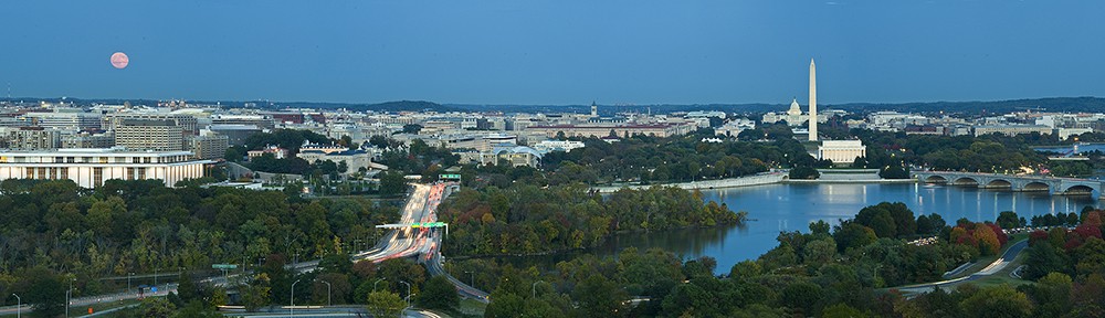
Moonrise over Kennedy Center, Washington, DC (20 minutes after sunset)

Night Photos Washington TwilightPhotographed 5 Minutes Later


My favorite technique for adding drama to a twilight scene is to include a rising or setting moon as shown below.  Taken in 2001, there was no “app” to guide photographers to the

Night Photos 1503-36 (retouch 9 X 14) Final 7600

Moonrise, Lincoln Memorial (7 minutes after sunset)

perfect location.  One needed a real compass and a source of information on the lunar cycle, such as the US Naval Observatory website.

Today, the easy availability of products such as The Photographer’s Ephemeris, Photo Pils, and others make it much easier.  But there still are a few additional elements that are helpful to know.   That will be the topic of the next installment of this series.

In the meantime,

Keep Shooting…..

Iceland Part 4 (Danger, Will Robinson, Danger!)

It’s been a busy time since the eclipse on 27 September, primarily because I am running around trying to get ready for my Open Studio Event in 7 days. But that is a subject for another post.  Today, it’s time to bring out some more images from Iceland.

Readers may have noticed that Icelandic place names tend to be extremely complicated and hard to pronounce.  But there is at least one exception, the small town of Vik located on the south coast.  Perhaps the most notable feature here is its black sand beach, characteristic of a country populated by active volcanoes.  Not far away are the cliffs of DyrhÓlaey where we spent the good part of the afternoon.  One doesn’t have to walk far from the parking lot to get a good view.

Iceland 22

Cliffs of DyrhÓlaey

The classic vista here, however, is from a promontory that looks back toward the cliffs.  It is only about a 10 minute walk from the location shown above.  This is a perfect example of how the scenery can radically change in a very short distance.

Iceland 17

View from the Promontory, Looking West

And after a 20-second stroll to the opposite edge of the promontory one is treated to this view.

Iceland 18

View from the Promontory, Looking East

That evening, the group visited the Reynisfjara Beach, best known for its sea stacks.  One thing to remember about photographing on a beach close to the water is the need to pay close attention to the waves.  I have always observed that precaution, except for approximately 3 seconds on that evening when I turned to respond to a question from another member of the group. In that brief moment an unusually large wave pounded ashore with surprising speed and water was suddenly rushing past me above my knees. I turned to rescue my camera and tripod but it was too late.  My camera was down, I followed, and I saw another member of our group being dragged into the ocean while he desperately held his camera and tripod above the water surging around him. One of the tour leaders reacted quickly and grabbed that camera before the water claimed it.  With his hands free, the downed member was able to get back up about the same time I did.  I retrieved my camera but it was ruined, as was the lens.  The photographs on the card, however, were unharmed.  The image below was taken just a few minutes before this happened.

Iceland 19

Fortunately, I had a back-up camera body and lens and managed to capture the sunset about 40 minutes later.

Iceland 21

Sunset, Reynisfjara Beach

Keep Shooting (but watch those waves)…….

Iceland: Part 3

Iceland is a land shaped by fire, ice, and water.   It sits astride two major tectonic plates which are being gradually forced apart by the pressure of molten rock deep within the earth.  At the surface glaciers inexorably move through the mountains, slowly carving new landscape formations.  The melting ice from the warming climate and heavy rainfall in the mountains generates innumerable waterfalls, some tumbling over cliffs 200 feet and higher.

As a result, there are spectacular opportunities for the landscape photographer when weather conditions cooperate.  During our time in Iceland, we were treated to a few special moments but more often found ourselves in fairly challenging conditions.  But the challenges are part of what motivates us to take our cameras outdoors whenever we can.  Because sooner or later persistence will be rewarded with a magical ephemeral moment.  A moment you never forget.

One of the favorite spots for photographers in Iceland is the small blue glacial waterfall called Brúarfoss. Although well known to visitors, it can be extremely hard to find.  Fortunately, we were on a photo workshop led by Ian Plant, ably assisted by Alex Mody, and Ian unerringly directed our driver through a maze of unsigned dirt roads to a trail head.  After a short hike we were there and it was immediately obvious why everyone wants to see it, even in poor weather conditions.

Iceland 12

Brúarfoss from the Pedestrian Bridge (wide angle photomerge)

Iceland 08

Brúarfoss, from the Shallows (wide angle photomerge)

Iceland 13

Brúarfoss, from the Pedestrian Bridge (telephoto photomerge)

The next day we arrived at Gullfoss (Golden Falls, located in the canyon of the Hvítá River) for a sunrise shoot, but my efforts to capture the grandeur of the monster cataract were mostly unsatisfactory.  However, a few attempts were OK and are shown below.

Iceland 14

Early Morning at Gullfoss, View to the West

Iceland 11

Workshop Participants, Gullfoss

Iceland 15

Brief (5 seconds) Rainbow, Gullfoss

At midday, we got a break in the weather just as we arrived at Seljalandsfoss, located close to the Ring Road (Route 1).

Iceland 07

Seljalandsfoss at Midday

Seljalandsfoss is a waterfall approximately 200 feet high.  It has a cavern to the sides and rear that allow people to walk behind the falls.  This image is a side view from within the cavern.

To be continued…….

.